Pont du Gard
The Pont du Gard is one of the greatest surviving sights of the ancient world — the tallest Roman bridge and the second-highest structure the Romans ever built, after the Colosseum in Rome, which is only six feet taller. It is a UNESCO World Heritage Site and is considered one of the finest works of Roman engineering still standing.
-04.webp)
The aqueduct was built to carry water from a source near Uzès into the Roman city of Nîmes, which was a major regional center. It served that purpose for about 500 years.
Getting There
Pont du Gard sits in the countryside between Nîmes, Avignon and Uzès. It is not on a rail line, which makes independent access awkward. Three practical options:
Package day trip from Avignon. The most convenient and comprehensive choice. Most tours combine Pont du Gard with other sights such as Saint-Rémy, Les Baux or Uzès. A guide adds substantial value at a site where the engineering story is much of the interest.
Rental car. Straightforward from Avignon, Nîmes, Arles or anywhere else in Provence. Parking is at the visitor center.
Public bus from Nîmes. Possible but time-consuming. The bus takes about an hour each way and runs infrequently — figure two hours round-trip just in transit, plus the walk between the drop-off traffic circle and the visitor center. Attention to the return schedule is essential, and a full day from Avignon combining Nîmes with Pont du Gard by train and bus requires an early start.
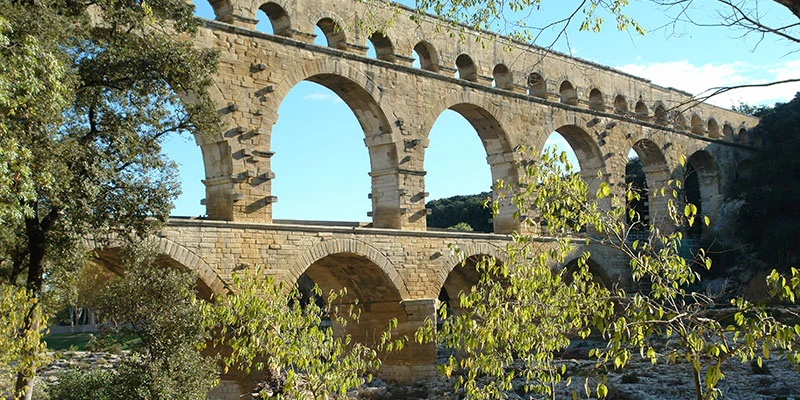
The Structure
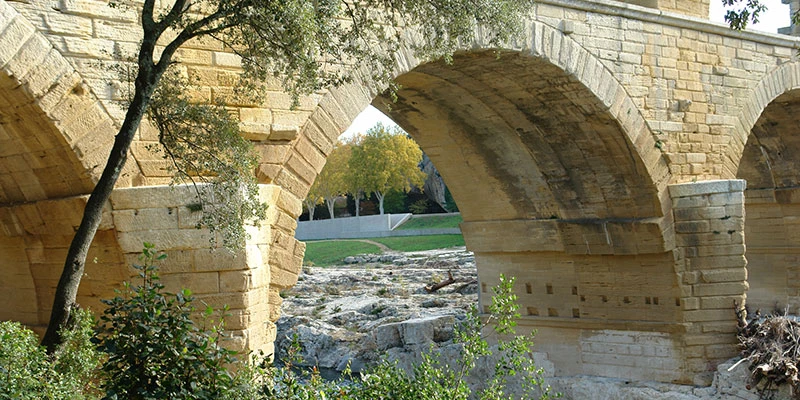
The middle arch is the largest the Romans ever built, on both the lower and upper levels — the widest span they ever crossed. On top, a covered water channel ran the length of the bridge, protected from the elements. The channel's interior was lined with a special stucco of pottery and tile shards, then sealed with olive oil, making it smooth and waterproof so that water flowed freely.
-04.webp)
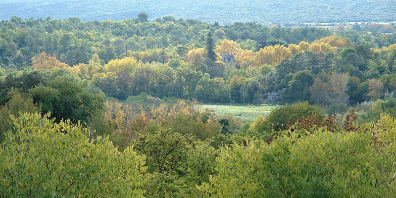
The channel is partly open and partly covered, forming a dark tunnel that tall visitors have to stoop through. The setting is dramatic — the river valley has forested, rocky shores on both sides, making the bridge feel at home in the landscape.
Viewpoints
Watch the Pont du Gard overview video →
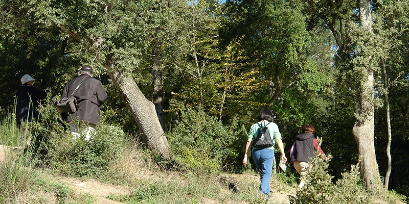
The paved path from the visitor center gives a decent first view of the aqueduct, but there is much better to be had with a little extra effort. Walk up to the bridge, then along a well-marked hillside path to the upper level. Steps lead higher still.
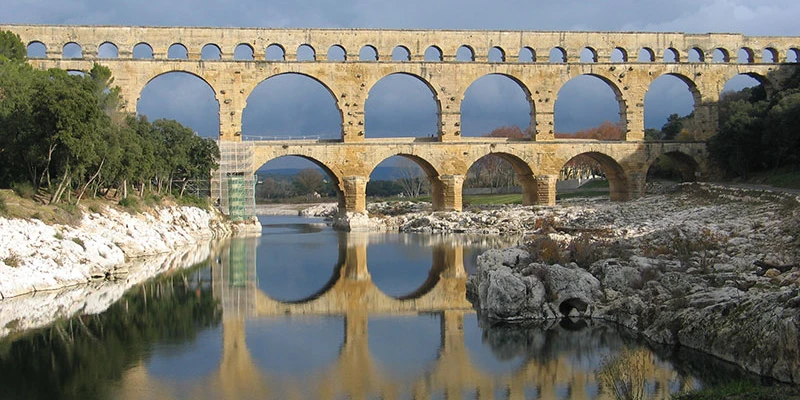
For the best overall view, walk across the bridge to the far side and down a path along the west bank of the river. In the afternoon the sun shines directly on the stones from this angle. The bridge is so large that standing close makes it hard to see — getting further away is essential.
Then cross back and walk up the path on the opposite side for a view straight along the length of the bridge, looking at the upper level head-on.
-04.webp)
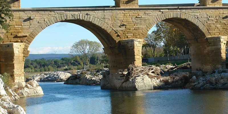
The very best view is from the riverbank on the sunny southeast side. Follow the stone staircase that winds under the aqueduct, then continue on the dirt path a few hundred yards along the water.
If the weather is calm, with mid-day or afternoon sun and no wind, leave the paved path and walk on the dirt bank down to the waterline. It is slippery, irregular and sometimes muddy, but the payoff is the perfect reflection — three levels of arches above, the same three levels mirrored in the river below, looking as if the aqueduct were twice its actual size. This view cannot be had from the paved path, and of the two million annual visitors only a small fraction make the extra effort to see it.
Watch the Pont du Gard engineering video →
Engineering
The Romans had no pressurized water pipes that could run downhill and back up. When an aqueduct met a chasm or river valley, it had to continue across as a bridge to maintain a level course. Pont du Gard exists because the Gardon River valley sat in the way of the line from Uzès to Nîmes.
The water source and the destination are only 12 miles apart in a straight line, but the aqueduct is 31 miles long, looping around foothills to follow the contours of the land. Total drop over the full length is only 41 feet — an average gradient of about 1 in 3,000. Across the Pont du Gard itself the channel descends only 2.5 cm. Toward Nîmes the channel is nearly flat, with sections running as shallow as 1 in 14,000. The water took about 27 hours to make the full run.
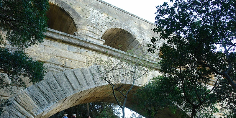
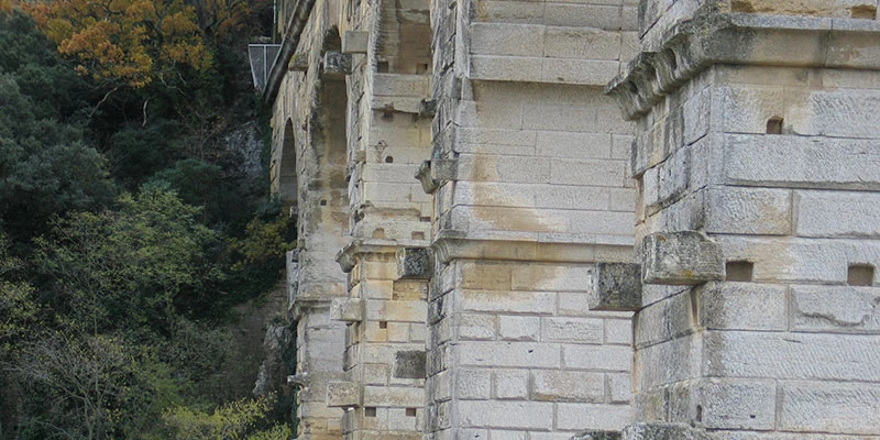
Four kilometers of the aqueduct are drilled through solid rock, an extraordinary precision for the period. The bridge itself is about 300 m long — a small fraction of the total aqueduct but the masterpiece of the line. The Romans chose this spot because the river is narrower here and a strong outcrop of rock in the riverbed supports the structure.
-04.webp)
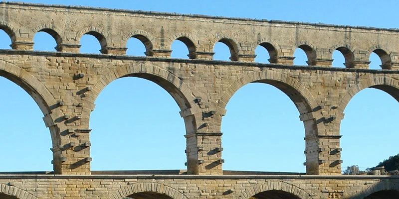
The stones were cut so precisely that most of the bridge was built without mortar or iron clamps, held together by gravity and friction alone. This was standard Roman practice. Such a structure can in fact withstand earthquakes better than a mortared one — the stones shift slightly and settle back, where a rigid mortared wall would crack. Only the water channel at the top used mortar, to waterproof it.
Watch the Pont du Gard local guide video →
Watch the combined Nîmes & Pont du Gard video →
At some times of day a guided tour takes visitors inside the water channel itself for a small additional fee — worth it if available, since it lets you walk the covered tunnel the water once ran through. Even without entering, you can see the channel clearly from outside on the upper-level walkway.
-04.webp)
During its centuries of use the channel required constant maintenance — plants and calcite accretions built up on the limestone and had to be scraped off to keep the water flowing. The protruding stones seen along the outside of the bridge held the original construction scaffolding and were left in place for future maintenance.
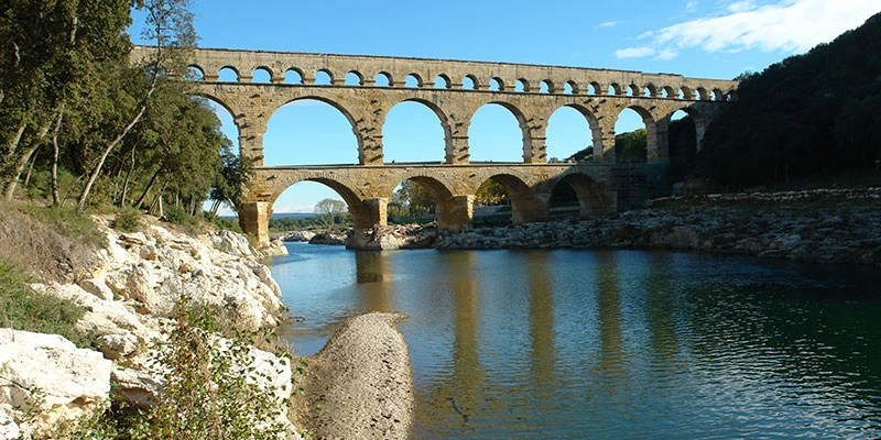
Three levels of arches support the water channel. The bridge took about five years to build, the full aqueduct about fifteen, with roughly a thousand workers — slaves and skilled craftsmen. The architect's name is not known; some have proposed Marcus Agrippa, a senior Roman statesman who built several aqueducts in Rome itself, but this is speculation.
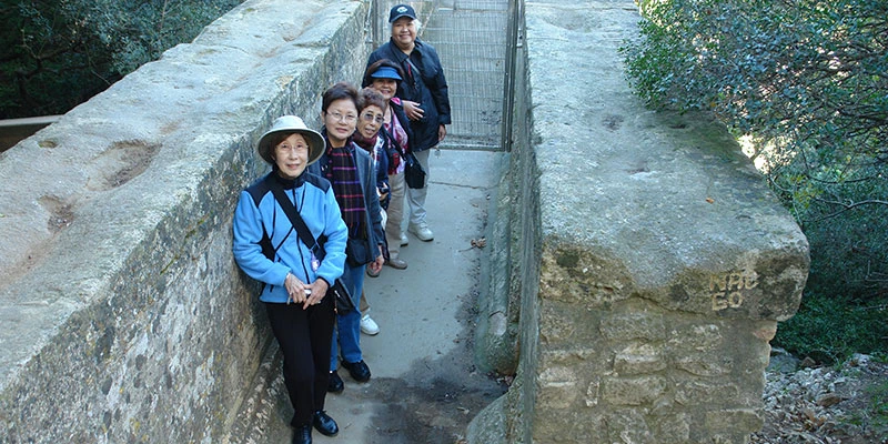
After the fall of the Roman Empire the aqueduct stopped carrying water but the bridge itself was too sound to abandon. It was used as a toll footbridge for another thousand years. In the mid-18th century a road bridge was added alongside the lower arches, wide enough for carriages. The added bridge is still used today by pedestrians crossing to the far side of the river.
-04.webp)
At the Site
The visitor center is the normal starting point — free maps of the paths and viewpoints, audio guides, restrooms, a café, a shop, and a museum with models and reconstructions that explain the aqueduct's construction and route.
The Pont du Gard is an hour from Nîmes by bus or half an hour by car, and easy to combine with Uzès, Saint-Rémy, Les Baux or Avignon on a day's touring through the surrounding countryside.